Welcome to the
Roscommon Open Data
Find, explore and query the council's public data: planning applications, zoning and local area plans, protected structures, polling stations, parks, budgets and more.
- 118
- Datasets
- 59,098
- Records
- 9
- Categories
What’s in my area?
Pick a town or click the map: your electoral area, polling station, zoning, landscape and flood zone, and the nearest library and car park.
Browse by category
Every public dataset from the council's ArcGIS Hub, grouped by topic.
Roscommon in layers
Towns and villages, roads, scenic routes, winter gritting routes, libraries and fire stations, drawn straight from the council’s published data. Pick a layer to open it, or combine any of them on the map.
Open the mapRoscommon in layers
drawn from this portal’s dataData story
Where the council’s budget goes
€54.5m of budgeted spending in 2018, from the council’s own budget tables. Roads take 37%, and the four years show where the net cost falls on local funding.
Read the story →Popular datasets
Open any dataset to preview it as a table or map, query it, and download it in the format you need.
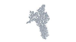 Points
Planning & Development
Planning Application Points
Planning Applications lodged with Roscommon County Council since 2010. Dataset Publisher: Roscommon County Council, Dataset language: English, Spatial Projection: Web Mercator, Update Frequency: Daily Field Descriptions: County: Planning Re
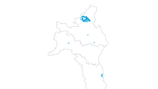 Areas
Planning & Development
Land-use Zoning - Roscommon County Development Plan 2022-2028
The Roscommon County Development Plan 2022-2028 is a document that sets out the overall strategy and vision for the proper planning and sustainable development of the county over the six year plan period. The Plan has been prepared in the c
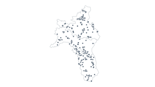 Points
Planning & Development
Record of Protected Structures - Roscommon County Development Plan 2022-2028
The Roscommon County Development Plan 2022-2028 is a document that sets out the overall strategy and vision for the proper planning and sustainable development of the county over the six year plan period. The Plan has been prepared in the c
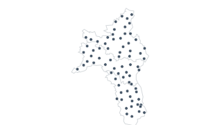 Points
Elections & Boundaries
Polling Stations
Polling Station Locations in County Roscommon. Dataset Publisher: Roscommon County Council, Dataset language: English, Spatial Projection: Web Mercator, Date of Creation: 2011, Last Updated: March, 2014, Update Frequency: As Required. Rosco
 Areas
Planning & Development
Derelict Sites Register
A derelict site means any land which detracts, or is likely to detract, to a material degree from the amenity, character or appearance of land in the neighbourhood of the land in question because of: 1.The existence on the land in question
Budget & Governance
Annual Budget 2018: Table A
This dataset contains data from Roscommon County Council’s Annual Budget. The budget is comprised of Tables A to F and Appendix 1. Each table is represented by a separate data file. Dataset Name: Budget 2018: Table A, Dataset Publisher: Ros
Recently updated
 Areas
Planning & Development
Planning Application Boundaries
Planning Applications lodged with Roscommon County Council since 2010. Dataset Publisher: Roscommon County Council, Dataset language: English, Spatial Projection: Web Mercator, Update Frequency: Daily Field Descriptions: County: Planning Re
PointsPlanning & Development
Planning Application Points
Planning Applications lodged with Roscommon County Council since 2010. Dataset Publisher: Roscommon County Council, Dataset language: English, Spatial Projection: Web Mercator, Update Frequency: Daily Field Descriptions: County: Planning Re
 Lines
Roads & Transport
Road Schedule
Roscommon County Council Road Schedule Dataset Publisher: Roscommon County Council, Dataset language: English, Spatial Projection: Irish Transverse Mercator, Date of Creation: 2020, Update Frequency: As Required. Roscommon County Council pr
 Lines
Roads & Transport
Winter Service Plan Routes
This Winter Service Plan is Roscommon County Council’s commitment to maintain a certain level of service on specified roads throughout the County. Level of service is maintained by responding to disruptive winter weather conditions causing
 Areas
Local Area Plans
Roscommon Town Local Area Plan 2024-2030 Landuse Zoning
Roscommon Town LAP 2024-2030
 Areas
Landscape & Heritage
Habitat Survey 2010: Fossitt Habitats (Towns)
Habitat Survey 2010 Roscommon
Using the data
Terms of use
Most of the council’s datasets are published under CC BY 4.0; a few state no licence. Each dataset page shows its own terms.
Find and use a dataset
Search by name or browse by category. Tables open in a sortable, filterable preview you can query with SQL; map layers open on a map. Everything downloads as CSV, and connects to the live ArcGIS service.
Missing something?
Ask the council’s GIS office at gisoff@roscommoncoco.ie, the contact listed on every dataset on the council’s Hub.
Reports and council tools
The council also publishes these reports and tools.
- Council website
Council meetings, services, news and how to reach council departments.
- Roscommon open data Hub
The council’s ArcGIS Hub, where these datasets are published.
Your ArcGIS stays the source
Nothing changes for the council’s GIS and open data team. Data keeps being managed in ArcGIS; this site reads it, can refresh on a schedule, and gives residents a faster way in: search across every dataset, tables and maps that load instantly, and queries that run in the browser.